Paste your text.
For single programmes, offers and new customers the travel text is enough. You don't need a connection for that.
 Create a map
Paste the itinerary, check the places, export – with a clear itinerary that takes three minutes. Round trip, world tour, city walk or wedding poster – in eleven designs, as SVG or PNG, ready for your layout.
Data stored in the EUGet started without signing in. You only need an account to save or buy. Paste your itinerary, and the map takes shape.
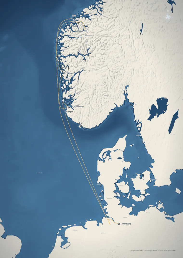
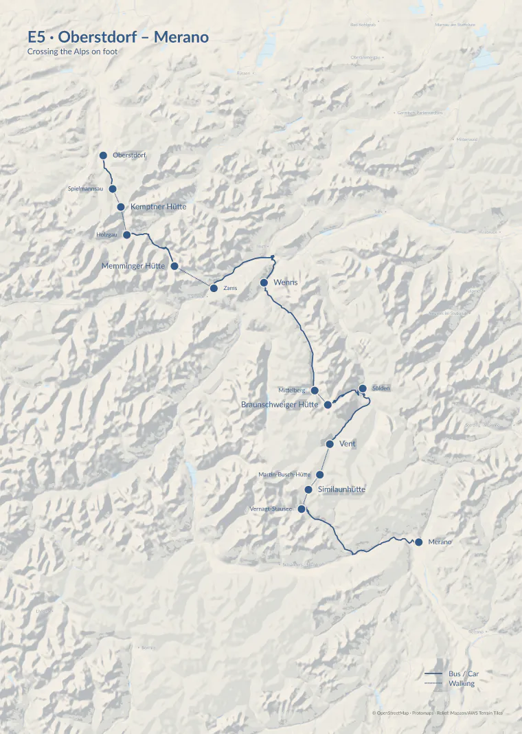
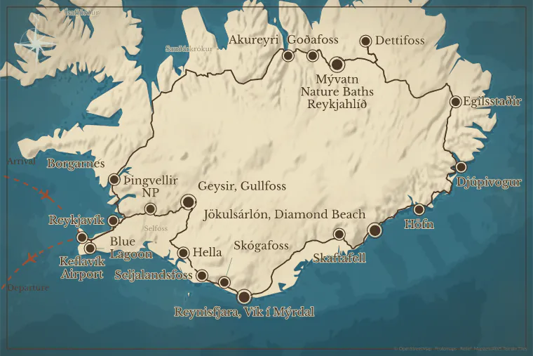
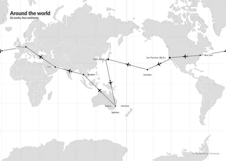
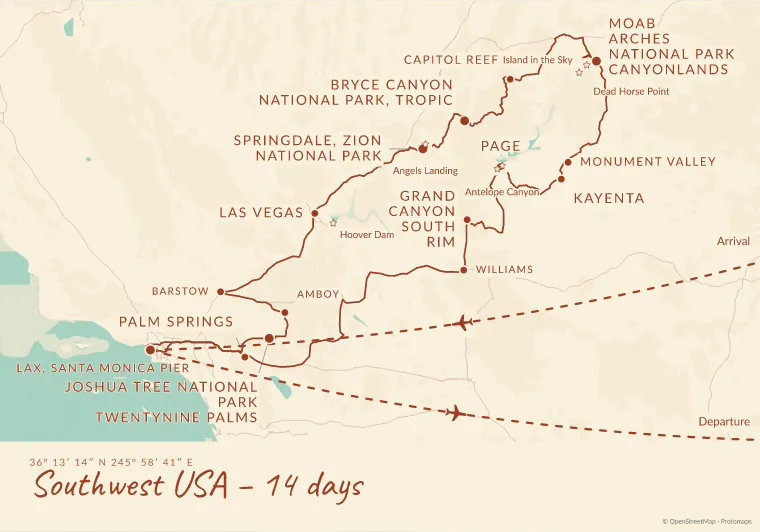
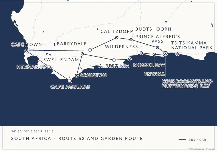
Round trip, cruise, long-distance trail, city walk or love story – nothing retouched, nothing redrawn. Filter by type of trip.
All trips are examples, not customer data. All pictures are unaltered exports. Map data © OpenStreetMap · Protomaps · Terrain: Mapzen / AWS Terrain Tiles.
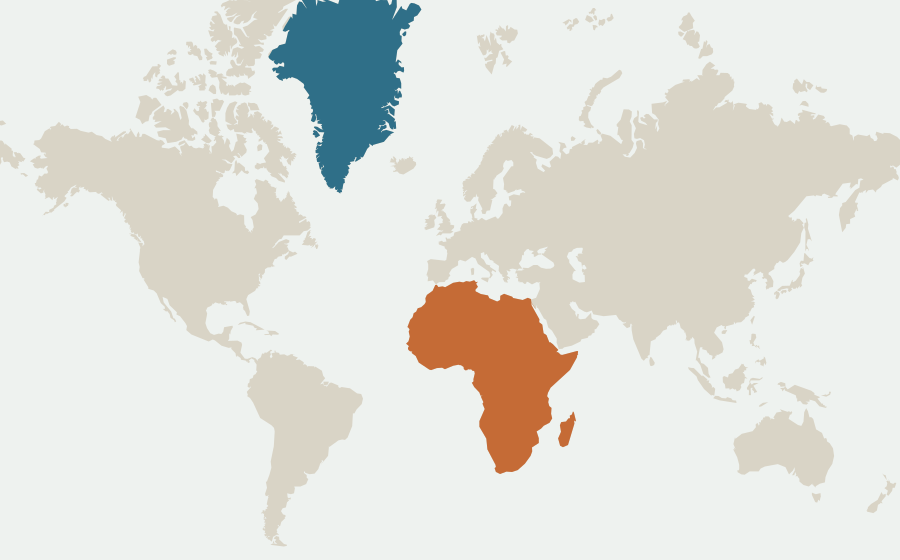
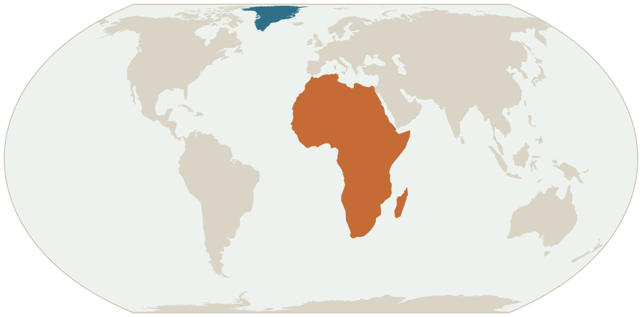
On 4 September 2026 the UN General Assembly adopted the resolution “Correct the Map” (UN press release). It recommends equal-area projections such as Equal Earth instead of Mercator for world and continent maps.
On request, maps.express draws your world and continent maps in Equal Earth – from the same data, in the same design, as SVG or PNG.
Africa 30.4 million km²Greenland 2.2 million km²
The AI reads stops and means of transport from your text. Fixed rules check every match before you see it. You go through the places and export – with a clear itinerary that takes three minutes, often less.
Unclear places or an elaborate design take longer. Place SVG and PNG straight into your catalogue or poster layout.Places, order and means of transport are already in your itinerary. The preview shows what was recognised. Where a place is unclear, you pick the right one in the search.
Create a map In the map studio you can start without signing in, or from a template in the gallery.Day 1: Arrive in Zurich, Switzerland.
Day 2: Take the bus to Lucerne.
Day 3: Continue to Interlaken.
Day 4: Take the train to Montreux.
Day 5: Travel by boat to Geneva.
Short map labels · transport modes · places to review
For single programmes, offers and new customers the travel text is enough. You don't need a connection for that.
If your travel system is connected, the itinerary comes straight from there. We work out together which systems can be connected.
From the first place to the finished file for your designers – and you decide what goes on the map.
Paste the itinerary or pick a trip from a connected system. The AI suggests the main stops and short map names.
Short names, clear stages, more room. Drag labels to the right spot and hide side trips.
As a vector graphic or a high-resolution image. On request the file carries the editing state, so you can open the map in the studio again later.
One click on a design and colours, type, base map and lines change together. Then you adjust each layer on its own – or leave it as it is.
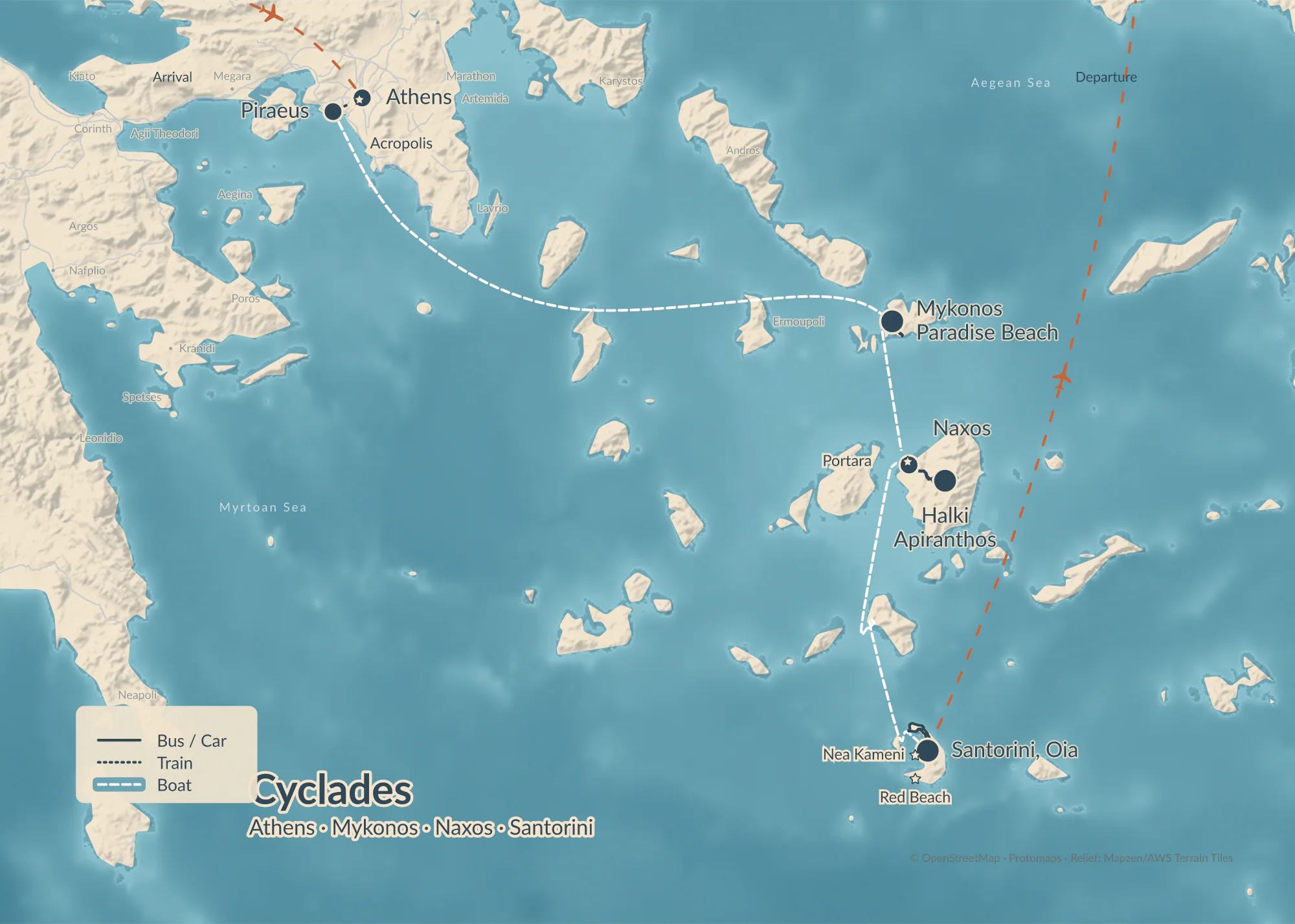
Every design on the same trip, each exported unaltered. Colours, layers and labels stay freely adjustable. We store your brand fonts and colours in your customer profile.
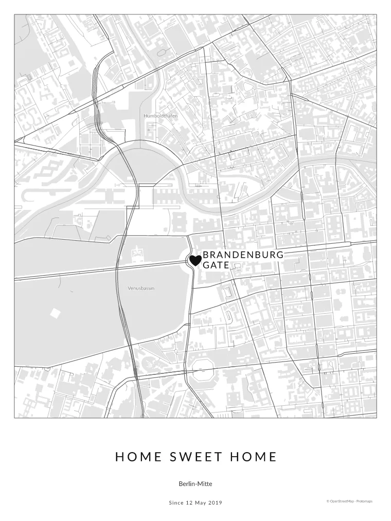 A heart, not a dotHeadlineNote & date
Gift, wedding, anniversary or your own home: you set the heading, subtitle and a personal note right in the studio. Special places get a heart.
The key moves right on the map, suggestions instead of required fields, and exactly as much detail as the map needs.
“Improve map” finds hidden names, lines through labels and stops at the edge of the sheet and suggests the fix right away: calculate roads, clear names, fit the view. On request an AI also checks whether the map reads well. You see every change side by side beforehand and switch it off if needed.
The same Iceland trip before and after calculating the roads – both unaltered exports.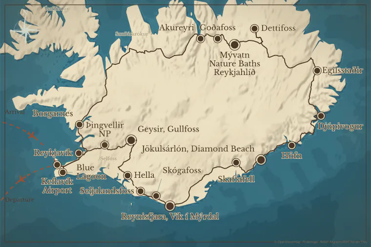
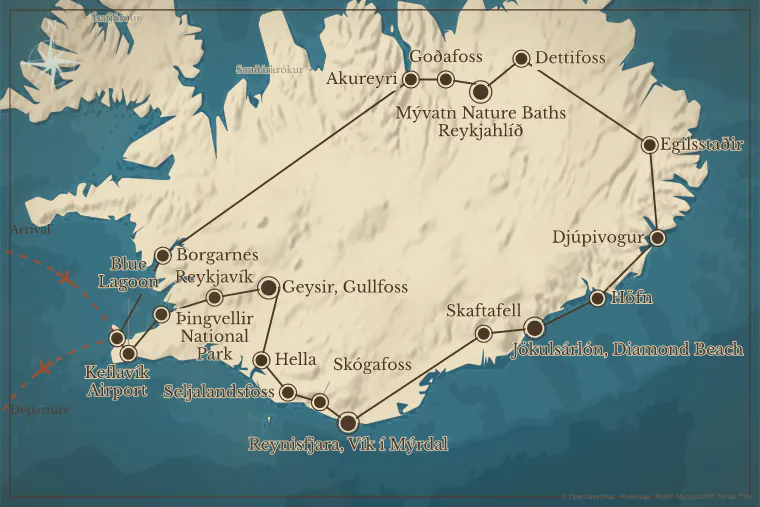 BeforeAfter
AI suggests short map names and separates main stops from side trips. You compare original and suggestion and keep only what fits.
Illustration of the suggestion feature. It always works from your own itinerary.maps.express arranges the labels automatically. For the finishing touch, simply drag a name to the right spot. A leader line connects it to its place.
Try it right here. On very dense maps some handwork sometimes remains.Bus and car legs follow the real roads, rail legs follow the tracks – for all legs at once if you like.
Car, bus, train, boat, flight and on foot, each with its own line style and one shared legend.
Terrain, peaks, water, roads, places and borders switch on and off one by one, each in three strengths.
From the city map with streets and buildings to the world map – across the date line too.
Search places and sights right in the studio and add or replace stops without rebuilding the route.
Accommodation, rental car or station as a symbol, with or without a label.
Studio and map labels in German, Swiss German spelling and English.
Load routes from GPX, KML/KMZ, GeoJSON or CSV straight into the studio. Export stops and legs for sat navs and GIS.
Select a point, change a name, move a label – the matching settings appear next to it.
The studio is only the surface. The same maps come from your travel system, from your editorial system or from a conversation with an AI assistant.
In pilot · access on requestmaps_from_itinerarymaps_updatemaps_renderDone: 24 stops, roads calculated. Shall I open the map in the studio?
Create, edit, render and export maps – with revision protection, preview images and print export.
AI assistants turn an itinerary into a finished map, change it in conversation and open it in the studio on request.
An AI assistant in the browser can work in the studio too – you confirm every change yourself.
The studio in your platform, with your fonts, colours, export presets and your sign-in.
Vector maps stay crisp when enlarged. For software without SVG there's PNG.
In the compact SVG, texts become paths. The map looks the same everywhere, even without the font installed.
With the embedded editing state you open the map in the studio again – even if the texts in the export are already paths.
Print files for catalogues and posters: SVG for vector workflows, PNG at print resolution.
The Iceland round trip from the gallery as an interactive map: your travellers fly along it stop by stop. With trips.express every booking gets a link like this.
The live map is not available right now. See the Iceland map in the gallery
Map: © OpenStreetMap contributors · Protomaps · EOxCloudless by EOX (Copernicus), edited, CC BY 4.0 · NASA
Your travellers get a link: the whole trip as an app under your brand, for anticipation before the trip and as a companion on the way, even offline. Your team runs everything in the cockpit.
The itinerary becomes a print-ready map in minutes, in eleven designs, as SVG or PNG.
The same platform for field teams: the day's jobs, the way there, photos from the site.
Start without signing in. You only need an account to save or buy.
Check places, design the map, download SVG or PNG. That way you quickly see whether maps.express fits your workflow.
maps.express is in its pilot phase. Paste your itinerary, and the map takes shape. The AI map check and bookable plans will follow.
We'll send you a short email when bookable plans are available. No advertising, no sharing, unsubscribe at any time.
For editorial teams and tour operators we set up brand fonts, export presets and the connection to your travel system, to fit your workflow.
We connect your booking and editorial systems and tune maps.express to your workflows. The API for automatically created print maps and the MCP server for AI assistants are in pilot operation; access is available on request.
Setup, operation and support are agreed depending on scope. We use your brand fonts as soon as your licence covers that use – we clarify this during setup.
Database, files and archives are kept in data centres in the EU. The pages are delivered through the Cloudflare network so they load quickly everywhere. Some extra features such as place search and road calculation use external services and receive location data for that, no personal data. We sign a data processing agreement with every customer. All details in the privacy policy
Unlock once, then export as often as you like.
The terms and conditions are binding.
For anyone who makes maps regularly: a monthly allowance of maps. The details are not settled yet.
Notify meFor tour operators and editorial teams who build maps into their workflows.
You design your map in the map studio for free. As a file you get a screen-size PNG, up to 1600 pixels wide, with the “maps.express” note, for private use. Print resolution, SVG and the print PDF without the note are paid.
No. You start without signing in. You only need an account to save and share. You can also buy a single map without an account. Until then, your draft stays in your browser.
Partly. Without signing in, the AI reads the trip text you paste and turns it into stops, up to 10 trip texts per day and internet connection. The map assistant is only available after signing in. Which data goes to the AI service is set out in the privacy policy.
Yes. When you sign in, the studio offers to move the draft from your browser into your account. We remove the copy in the browser only once the map is saved in your account.
Without an account your draft is valid for 30 days from the last change; after that the studio no longer opens it. In your account, saved maps are kept. We only delete personal workspaces automatically in which no map was saved and nothing was bought within 90 days of creation.
Yes, a few. Without signing in, the AI reads up to 10 trip texts per day and internet connection; once the shared daily allowance is used up, it continues the next day. To prevent misuse, other functions have usage limits too.
Yes. You delete the draft in your browser yourself: in the map studio with “Entwurf verwerfen” (discard draft). Your account is deleted on request by email to hello@maps.express; after a 14-day withdrawal period we delete it permanently.
No. What you have bought in a pack stays yours, with no expiry date.
Yes. Within 14 days you can withdraw from any map you have not yet unlocked.
As soon as provision of your file starts, and only if you expressly agreed beforehand. With an account, this applies to each map separately, when you unlock it in the export dialog. Without an account, you agree before paying, and provision starts right after payment. If the file is not finished, you receive it later or get your money back.
Yes. A map you have unlocked at a higher tier includes the lower ones: Print also includes Vector and Image. A private unlock, however, never covers commercial use.
No. You pay for the function (image, vector or print PDF) and the use (private or commercial), not for the size. You can export an unlocked map in screen format and from A5 to A2, as often as you like. The tier decides which files you get: a print PDF comes only with the Print tier.
You can upgrade the map to a higher tier in the export dialog. You see the price there before you buy.
Only when the file is finished. If the file fails, no map is used up, and another try costs nothing.
No. You buy packs with several maps of one tier. Your account shows how many of them are left.
An unlock covers one map and its revisions. If it turns into a substantially different map, a new unlock is required. Corrections and design changes to the same trip or region are covered, as often as you like. For a different trip or region you need a new unlock.
After the purchase everything stays free as long as it remains the same trip – texts, design, format, more or fewer stops; you only need a new unlock once it becomes a different trip, meaning a different country or hardly any of the purchased stops left.
Yes, a single map. You pay Polar and give your e-mail address there. Packs are only available with an account. Your own photos are not included in the files.
The map as it is at purchase, as finished files of your tier in the map’s format. A print PDF always comes on a sheet, on A3 if the map has none. Before buying, you choose which files we create; you can add the others afterwards on the same page at no extra cost, as long as your files are available. You cannot change the map or download it in other sizes. That only works if you buy with an account.
Right after paying, on the confirmation page. Once all files are ready, we also send the download link to the e-mail address from the checkout. Please do not pass the link on: it leads to your files.
For 90 days from payment, up to 20 downloads a day. After that we delete the map and files and cannot restore them, so please save the files yourself. Your right to use the downloaded files remains.
Not yet. If you want to change the map later, buy with an account.
We automatically try again. If that does not help, you receive an e-mail from us, and we get back to you with the file or with your money back. You can also write to hello@maps.express with the invoice number from Polar’s receipt.
Refunds go through Polar. The link and files then stop at once, and we delete the map in the next hourly run.
From Polar by e-mail, in addition to our e-mail with the download link.
A copy of your map and the files for 90 days, your e-mail address only encrypted until the link is sent, for at most 7 days. The details are in the privacy policy.
Polar is our reseller (Merchant of Record): you buy from Polar, Polar issues your invoice and pays the VAT. The invoice arrives by e-mail. You can also find it in the Polar customer portal, which you reach in the map studio under “Account & purchases”.
Yes. All prices are shown including VAT. Businesses with a valid VAT ID in the EU pay without VAT under the reverse charge procedure.
Yes, if your VAT ID is valid in the EU. Polar then bills without VAT under the reverse charge procedure. To do so, tick “Purchase as a business” in the checkout and enter your VAT ID.
No. You sign in everywhere with the same .express login.
We automatically delete a personal space in which, 90 days after it was created, no map has ever been saved and nothing has been bought. Accounts with maps or purchases are not affected.
Write to hello@maps.express. After your request, you can take the deletion back for 14 days; after that, we delete for good. Deletion applies to your .express account and therefore to all .express products. Paid maps from packs that you have not used yet lapse without a refund.
Your purchases remain as bookkeeping records because we have to keep them for tax reasons. We do, however, delete the link to you as a person: unlocks and consents no longer carry any personal reference afterwards. Your invoices remain in the Polar customer portal.
With the “Commercial Print” tier you get PNG, SVG and a print PDF in CMYK with bleed. “Commercial Vector” includes SVG and PNG. The file is created on our server; this can take a moment.
Yes. You can export any unlocked map again from your account. When you buy without an account, you download the finished files through your link for 90 days.
Check the colours in the output preview of Adobe Acrobat. Apple Preview does not display CMYK files reliably.
Depending on the map, among others from OpenStreetMap (licence ODbL, which is why there is a notice on the map), Natural Earth (public domain) and, for the relief, Mapzen Terrain Tiles. Every map carries its source reference, and the line on the map leads to a sources page.
With the export ID you can find a specific file again, and we can trace when it was created if questions arise. The fingerprint describes only the map, not you. It contains no personal data.
From us, Polar only receives a pseudonymous identifier of your account, or just the purchase number if you buy without an account. In the checkout, Polar as the merchant collects your e-mail address, name and billing address, plus payment details and, for companies, company details. Polar is a US company; the transfer is protected by EU standard contractual clauses, including for Switzerland.
By card, Apple Pay, Google Pay and some local methods such as EPS or iDEAL/Wero. Purchase on invoice, SEPA direct debit, PayPal and TWINT are not available. Businesses that have to pay by invoice can write to us; this requires a contract.
Not at the moment. You pay in euros and your bank converts the amount. Swiss VAT is included in the price; Polar pays it as the reseller.
This can happen. Polar may refund on its own within 60 days to avoid disputes with the bank. The purchase then counts as withdrawn: unused maps from the pack lapse, maps already unlocked stay. If a map already used was refunded, new unlocks are blocked. Contact us if this was a mistake.
The terms are binding; for purchases without an account, together with the Terms for buying without an account. All questions